McLaughlin Canyon, Okanogan County
A geological wonder in North Central Washington. Millions of years of history carved into stone.
Explore the Canyon400-Foot Gneiss Cliffs. 1,000 Feet of Caves. One Canyon.
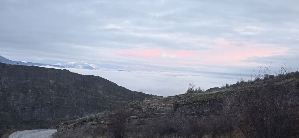
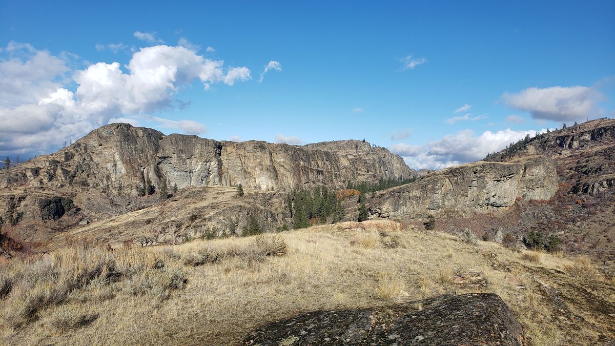
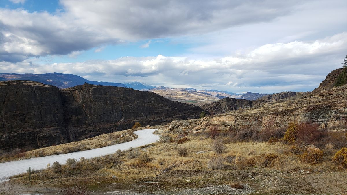
McLaughlin Canyon is a geological formation in Okanogan County, North Central Washington, located 4 miles south of Tonasket off US Highway 97. The canyon features gneiss cliffs exceeding 400 feet in height, over 1,000 feet of interconnected fracture caves, 103 documented rock climbing routes, and a hiking trail that follows the same path miners, fur traders, and indigenous peoples traveled for centuries.
Geology
The canyon walls are composed of Tonasket Gneiss, a metamorphic rock that is part of the Okanogan Metamorphic Core Complex, a structure approximately 50 million years old. During Eocene extensional collapse, igneous and metamorphic rock from deep in the earth's crust rose to form a dome as overlying rock slid westward. The result is exposed here as towering cliff faces of recrystallized granite. This is not the Columbia River Basalt that dominates most of eastern Washington. The rock at McLaughlin Canyon (also spelled McLoughlin Canyon) is far older and structurally distinct.
On the southwestern slope of Tonasket Mountain, the canyon contains over 1,000 feet of interconnected fracture caves and crevasses. Some passages are naturally lit through narrow overhead slits reaching 20 to 40 feet high. Others require artificial light and short technical rappels to access cool, moist lower chambers beyond casual exploration.
History
McLaughlin Canyon is the site of the only armed conflict between settlers and indigenous peoples in Okanogan County history. On July 29, 1858, warriors from the Chelan, Okanogan, and Columbia tribes ambushed a party of approximately 160 miners, traders, and packers traveling north toward the Fraser River gold fields in British Columbia. The party was led by David McLoughlin, son of Dr. John McLoughlin, the Hudson's Bay Company's chief factor of the Pacific Northwest. Firing continued for several hours near the mouth of the canyon before the caravan retreated to the Okanogan River. A historical marker erected by the Okanogan County Historical Society stands at the site.
The canyon trail follows what was originally the Hudson's Bay Company Brigade Trail, used for fur trade in the early 1800s. It later became known as the Caribou Trail during the 1850s Gold Rush, serving as a major north-south transportation corridor between the Columbia Plateau and British Columbia.
Recreation
The hiking trail is a 2.5 to 3 mile round trip with approximately 200 feet of elevation gain, rated easy, and managed by the Bureau of Land Management. No pass is required. The trail descends the canyon toward the Okanogan River, passing through landscape recovering from wildfires in 2007 and 2015, with spring wildflowers on the regenerating slopes.
McLaughlin Canyon supports 103 documented rock climbing routes across nine named climbing areas, including the Last Wall and South Buttress. Routes range from 5.7 to 5.12 on gneiss, with 76 sport routes, 25 trad, and 2 toprope. All rock south of the county road is public BLM land. All rock north of the county road is private and off-limits.
Rattlesnakes are present from April through October. The nearest services are in Tonasket, 4 miles north on Highway 97. From Seattle, the drive is approximately 4.5 hours. From Spokane, approximately 3 hours.
The Canyon
Explore
History
The 1858 ambush, the Brigade Trail, and centuries of human story written into the canyon walls.
Geology
400-foot gneiss cliffs, fracture caves, and the Ice Age forces that carved the Okanogan Valley.
Recreation
Hiking, wildlife viewing, and seasonal activities across the canyon and surrounding landscape.
Rock Climbing
Sport and trad routes on gneiss. The jewel of the Okanogan for climbers willing to make the drive.
Getting There
Directions, trailhead parking, BLM boundaries, seasonal access, and safety.
Local Amenities
Lodging, dining, fuel, and services near Tonasket and the surrounding area.